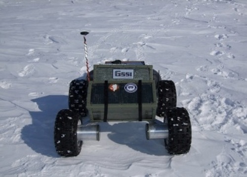
Figure 1: The Yeti Robot
This project will aim to fuse data from two discrete sensor suites in order to classify terrain. These sensor suites will include a vision system and a proprioceptive sensor system with motor current sensors, an inertial measurement unit (IMU), wheel encoders, a GPS, and an optical velocity sensor. All of these sensors will reside on an all-wheel drive robot called Yeti.
Figure 1: The Yeti Robot
With the fusion of these two sensor suites, the group hopes to maximize the strengths of each, with each compensating for the other's weaknesses. The vision system's strengths include being able to classify a terrain from a distance, which could be very important in the case of an autonomous vehicle when trying to prevent immobilization. Its weaknesses, however, comes when a terrain is visually difficult to classify, such as undisturbed snow, or sand. The mobility of these terrains is difficult to determine visually. The proprioceptive sensor suite, on the other hand, can classify terrain as it is driving over it. An important strength of the system in cases where it is visually impossible to classify a terrain or its mobility, but at the same time a weakness since the vehicle must attempt to traverse the terrain before it can make a prediction about its safety.
The classification methods to be used in this project will be supervised learning methods with hand-labeled training data. Possible methods include support vector machines, k-means clustering, and hidden Markov models (Bajracharya et. al 2009, Bishop 2006, Dugad 1996). Support vector machines and k-means clustering both look to separate out the different categories of data in some dimension spatially, whereas hidden Markov models use temporal data in order to make their classification.
Proprioceptive data will be collected from the Yeti robot, which is equipped with all of the sensors listed above in the proprioceptive sensor suite. A camera connected to a netbook will collect the vision data as a series of frames. The data will be collected from an area behind the Thayer School of Engineering that has both pavement and grassy areas. To reduce the excess dimensionality of the data, a few basic pieces of information about the terrain immediately in front of the robot will be extracted. Color and visual texture have been suggested as possible identifying characteristics (Brooks and Iagnemma 2009).
To collect data, first the robot will be manually driven over the terrain, then pictures will be taken of the areas that the robot drove over. The combination of sensor data that will best classify the terrain will be determined in order to train our machine learning algorithm.
By the milestone due date, all of the training and bench testing data will be collected and the combination of sensor data that best classifies the terrain will be identified. The machine learning algorithm will be chosen, and training will have commenced.